|
|

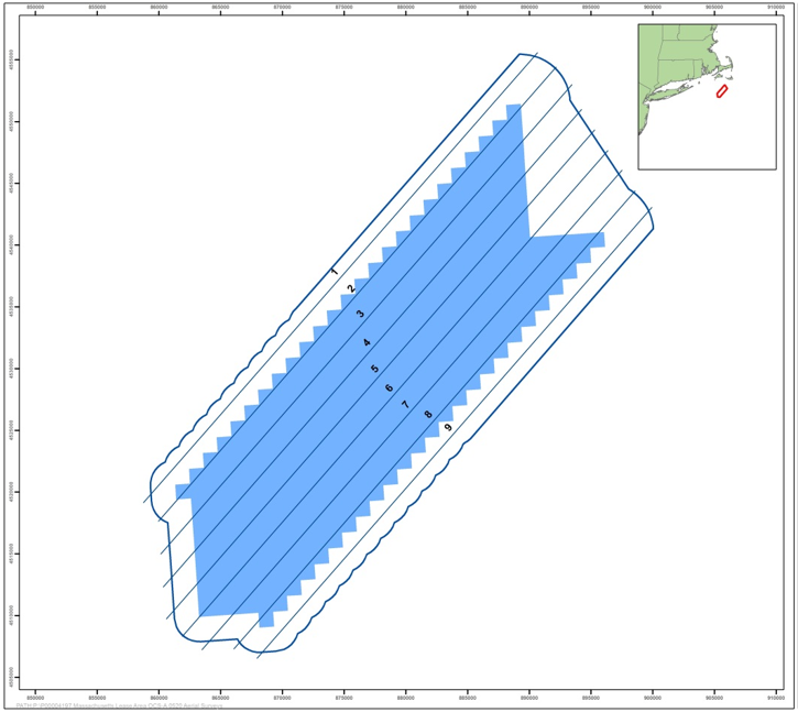 MA OCS-A 0520 Lease Area and the irregular 1 nm / c. 4 km NE km buffer showing the aerial survey flight lines.
|
ReMOTe for Equinor's Lease Area OCS-A 0520 Equinor has initiated offshore high-resolution aerial surveys of the Massachusetts Lease Area (OCS-A 0520) to evaluate marine fauna use of the lease area and vicinity (Figure 1). The surveys use APEM Inc.'s ultra-high resolution aerial digital imagery to characterize the use of the area by birds, marine mammals, sharks, rays, sea turtles, and large bony fish. The surveys are designed to provide baseline information for conducting impact assessments and to meet the U.S. Bureau of Ocean Energy Management's (BOEM's) requirements for environmental review of offshore wind projects. A total of 16 diurnal surveys will be completed from December 2019 through November 2020, consisting of 12 monthly surveys with one additional survey per month completed during April, May, August, and September. APEM Inc. and Normandeau Associates, Inc. (Normandeau–APEM team) extract and identify avian and other marine species and QC the results. As data review progresses, survey results are available on Normandeau's ReMOTe data portal in real time. |
Example Images Collected from the Surveys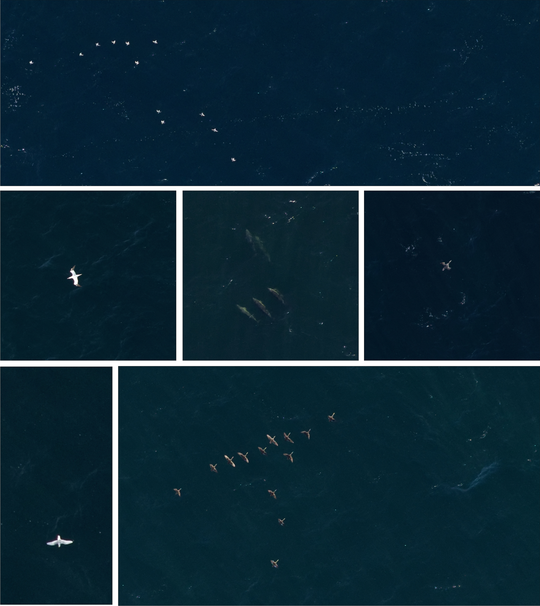
|
.jpg)