|
|

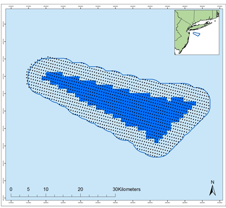 New York Bight offshore wind lease plus a 4 km (2.5 mile) buffer showing image capture locations for the grid surveys.
|
ReMOTe for Equinor's New York Bight Lease Area Equinor has initiated monthly offshore high resolution aerial surveys of birds and other marine life in the New York Bight offshore wind lease plus a 4 km (2.5 mile) buffer. The surveys use APEM Inc.'s ultra-high resolution aerial digital imagery to characterize birds present in the lease area and gather additional information on other marine fauna. These surveys will provide the baseline information required for conducting impact assessments and will meet the U.S. Bureau of Ocean Energy Management's (BOEM's) regulatory requirements for environmental review of Wind Energy Areas. The years worth of monthly surveys started in November 2017 and will compliment similar surveys conducted in the surrounding area. APEM Inc. and Normandeau Associates, Inc. (Normandeau–APEM team) extract and identify avian and other marine species and QC the results. As data review progresses, survey results are available on Normandeau's ReMOTe data portal in real time. |
Example Images Collected from the Surveys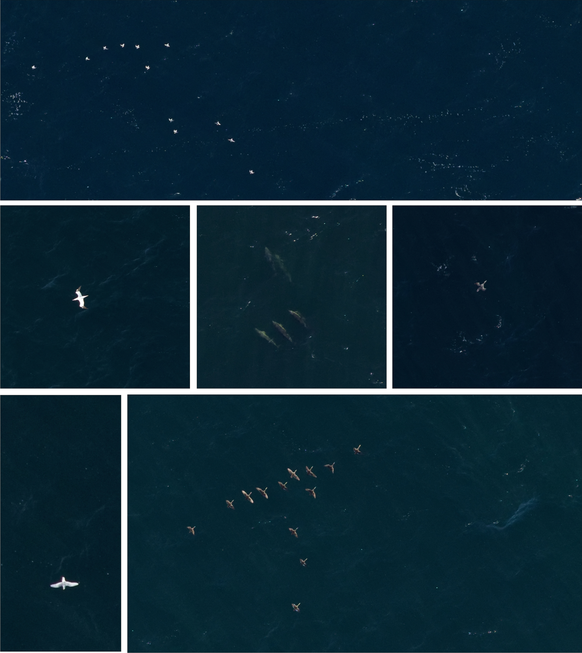
|
.jpg)