|
|

Aerial Digital Surveys
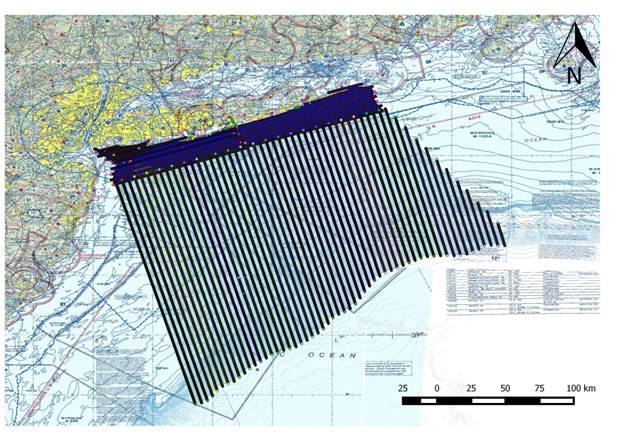 New York Offshore Planning Area (OPA) showing transect survey lines.
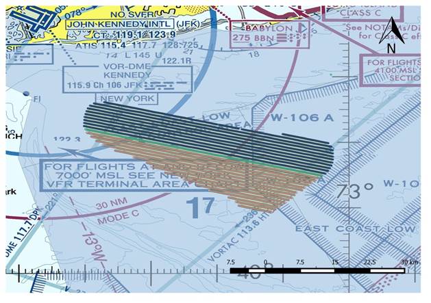 Wind Energy Area (WEA) and the 4-km buffer showing image capture locations for the grid surveys.
|
How ReMOTe for NYSERDA Works The data collected in the surveys of the OPA and WEA are uploaded to ReMOTe after each survey. Normandeau and APEM analysts and taxa-specific experts log in to ReMOTe to access the data, identify species, and interpret results. As data review progresses, survey results are available on ReMOTe in real time. NYSERDA Project Advisory Committee (PAC) members and other interested parties can log in to ReMOTe to access the data. |
Example Images Collected from the Surveys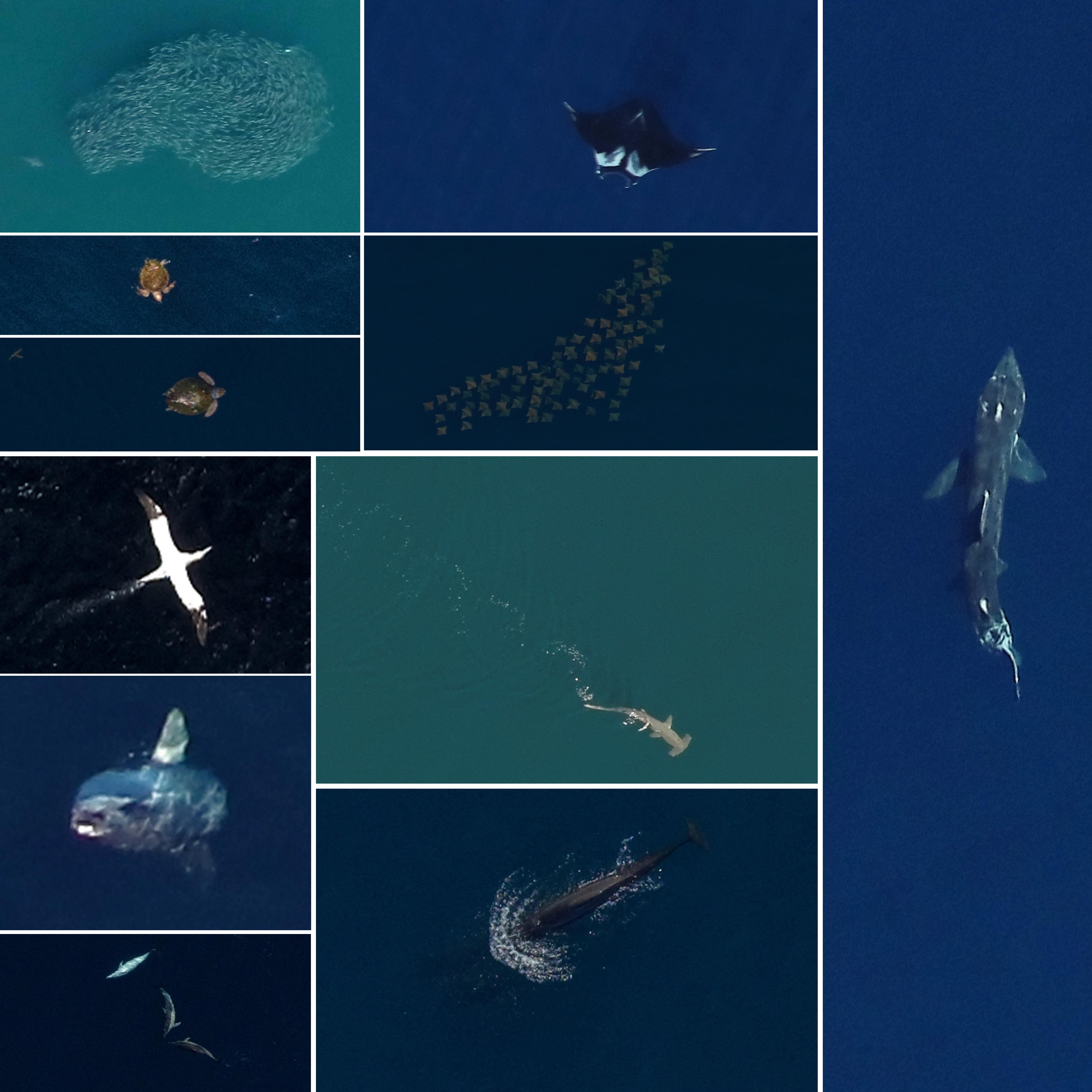
|
Data Citation
Normandeau Associates and APEM data prepared for New York State Energy Research and Development Authority. Aerial Digital Baseline Survey of Marine Wildlife in Support of Offshore Wind Energy. 2019.
Images Citation
APEM and Normandeau Associates images prepared for New York State Energy Research and Development Authority. Aerial Digital Baseline Survey of Marine Wildlife in Support of Offshore Wind Energy. 2019.
.jpg)