|
|
|
|
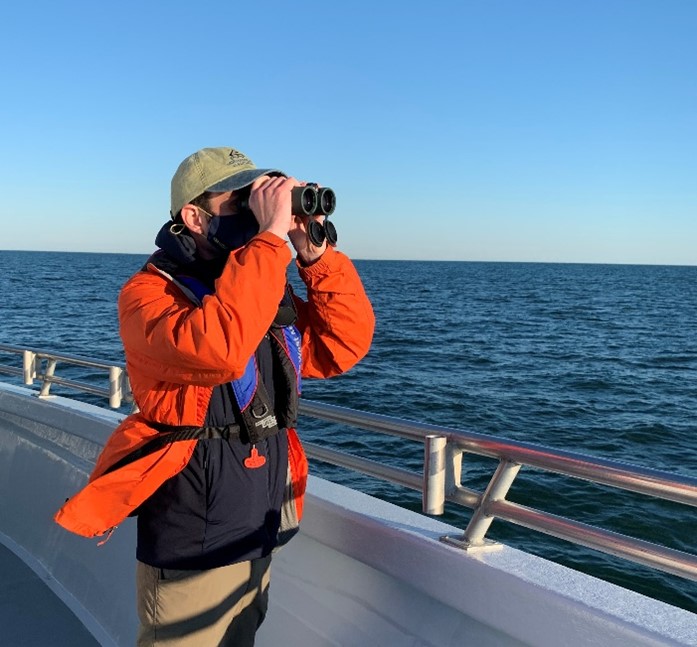
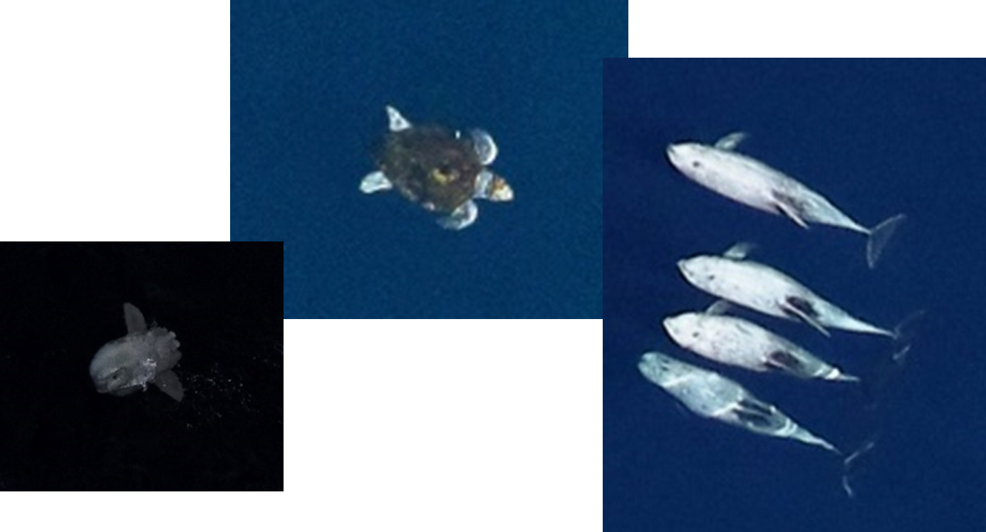
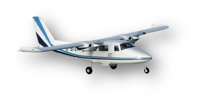
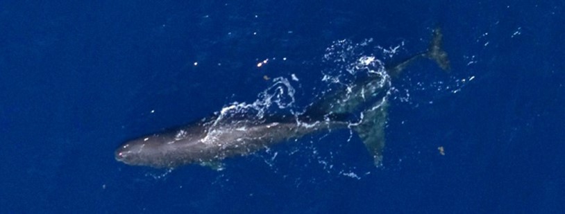
US Wind is developing the Maryland Offshore Wind Project, an offshore wind project with up to 2 gigawatts of generation capacity within an area leased from the Bureau of Ocean Energy Management (Lease OCS-A 0490) off the coast of Maryland on the Atlantic Outer Continental Shelf. The Project would include as many as 121 wind turbine generators, up to four offshore substations, and one fixed-platform meteorological tower in the roughly 80,000-acre Lease area Taking a responsible approach to potential development, US Wind is committed to industry-leading environmental research that will enhance protections for marine life as they develop this clean energy resource for the region. US Wind has implemented many different studies within and in the vicinity of OCS-A 0490 including aerial digital surveys to study the impacts of traffic separation and vessel traffic on birds and other species, buoy-based acoustic studies for birds, bats, marine mammals, fish, and environmental sound, boat-based acoustic studies for bats and boat-based protected species observer surveys aimed at protecting marine mammals and turtles. All of these studies are being undertaken with expert collaboration. US Wind has partnered with Normandeau-APEM, OceanTech-Normandeau, University of Maryland Center for Environmental Science (UMCES), and ESS Group (part of TRC Companies) for providing studies and assessments. Specifically:
In addition to the wildlife research efforts here, US Wind has conducted other surveys in support of the Construction and Operations Plan (COP) submitted to the Bureau of Ocean Energy Management. All of the public COP documents are available here: https://www.boem.gov/renewable-energy/state-activities/us-wind-construction-and-operations-plan
|
|
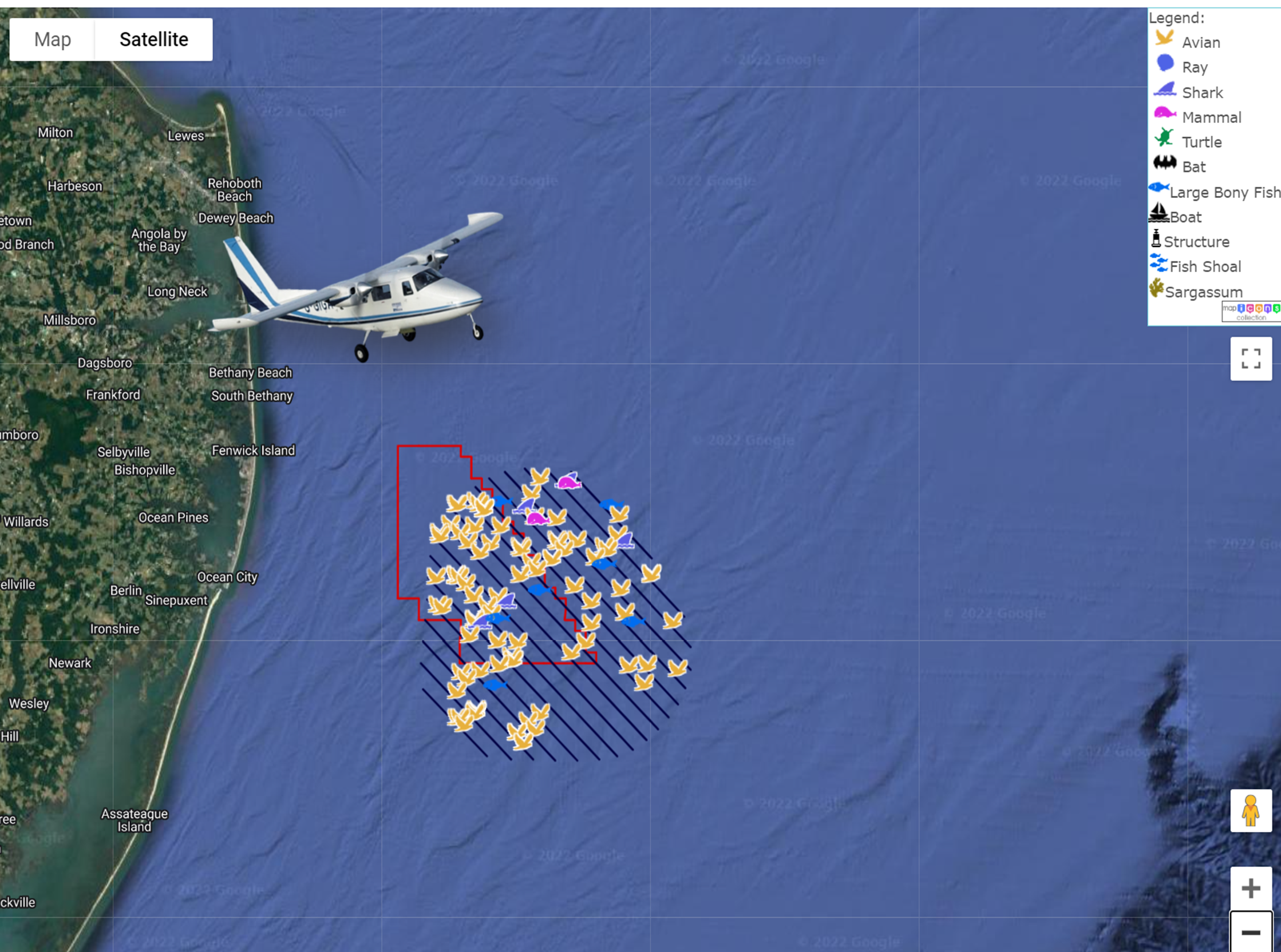
Two years of aerial digital surveys have been planned in the first area to be developed within the US Wind Lease Area OCS-A 0490. OCS-A 0490 has United States Coast Guard (USCG) vessel traffic lanes running parallel with the Site's eastern boundary, finishing approximately halfway along the length of the area. USCG plans to extend the traffic separation scheme (TSS) to the full extent of the Project boundary. The effects of vessel lanes and TSS on species distributions and densities are unknown. Understanding these interactions will help understand future postconstruction differences when compared with historical baseline information on distributions and densities. Adjacent active Lease Area OCS-A 0519 has the potential to displace birds once constructed, and this could influence species distributions. Figure 1 shows the current and proposed extents of the TSS, and the location of adjacent active Lease Area OCS-A 0519. The survey design focuses on two surveys: one before TSS extension and one after TSS extension. This design should provide some insight in to how the TSS can influence species distributions. This survey design provides a 10-km (5.4-nmi) buffer around the first construction campaign. Figure 2 shows the survey design and illustrates what a 10-km buffer would look like around the entire Project (i.e., samples part of the buffer and displacement area of the neighboring active lease area OCS-A 0519 and sampling an active TSS). See the Avian Monitoring Plan here: App II-N2 Avian Monitoring Plan.pdf |
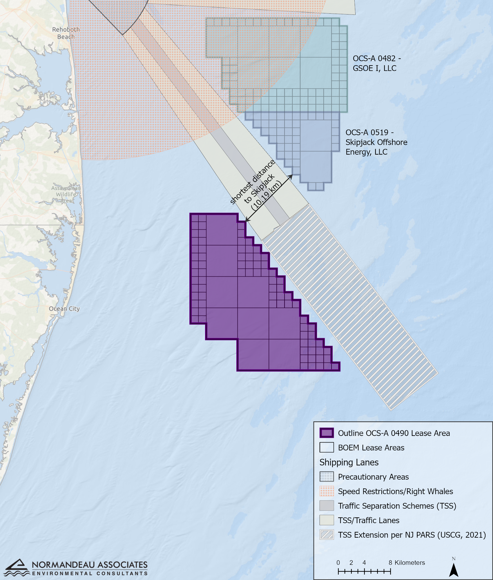
Figure 1. Location of OCS-A 0490, adjacent current and proposed vessel Traffic Separation Scheme, and proximity of other active lease areas
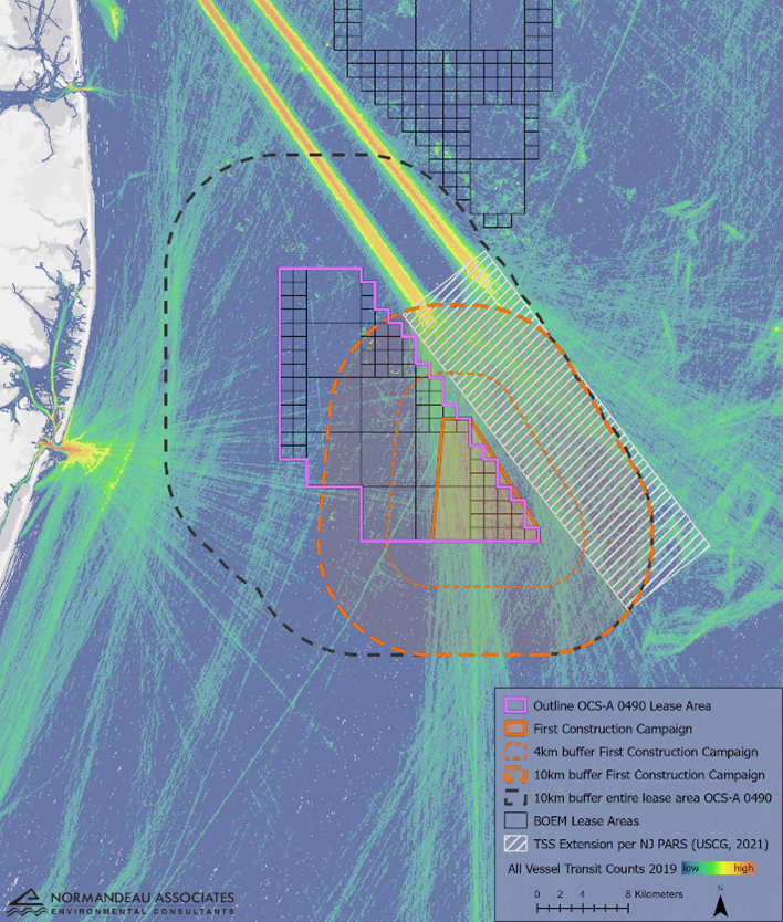
Figure 2. Large orange dashed outline of the spatial extent of the first survey design illustrates coverage of the TSS extension and coverage of ~66% of the US Wind Project.
|
|
|
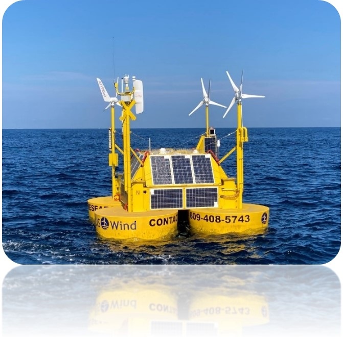
Offshore Metocean Data Deployment of a metocean buoy and use of remote sensing is providing continuous supplemental ecological information within the US Wind Lease Area OCS-A 0490. Data are collected continuously, both day and night and above and below the ocean's surface. The metocean buoy/TRBM is carrying the following additional sensors.
Nanotag antennas provide species-specific information gleaned from tagged birds. In collaboration with FWS, information shared will include tagged endangered species including Red Knot, Piping Plover and Roseate Tern. Bird Acoustic sensors constantly record diurnal and nocturnal bird calls. These bird acoustic sensors will help fill data gaps for spring and fall migrant passerines, including warblers, grosbeaks, buntings, pipits, thrushes, and redstarts. Bat Acoustic sensors record migrating bat calls. Migrating bat species commonly occur in August and September and include Eastern Red Bat, Hoary Bat and Silver-haired Bat |
|
.jpg)