Normandeau Associates, Inc., a highly regarded U.S. environmental consultancy, and APEM, Inc., the U.S. subsidiary of the global leader in digital aerial surveys of offshore wildlife, have teamed up to offer ultra-high resolution aerial wildlife surveys for the successful permitting of offshore wind farms in the U.S.
The Normandeau‐APEM team combines extensive knowledge of innovative technology and methods with scientific integrity and regulatory experience. Together we are providing a new standard for gathering offshore wildlife data in North America based on established European methodology.
Our approach is to work with you to design a cost-effective solution based on the unique needs of your project. The process begins with clearly defined scientific-study designs created by the Normandeau‐APEM team. We offer flexible equipment and aircraft options to meet project-specific requirements. We also provide expert scientific identification of the wildlife within images.
APEM's custom camera system is the highest resolution in use for digital offshore wildlife surveys anywhere in the world. Normandeau developed ReMOTe (an online data portal) for large data storage, efficient data processing and analysis, and visualization.
Solid, reliable results to inform your decisions
The superior data quality, lower cost, and increased safety of ultra-high resolution aerial imaging has replaced vessel-based observation as the predominant wildlife survey tool for offshore wind ecological studies in Europe and beyond.
Normandeau–through a pilot study for BOEM–has developed new tools and protocols for adapting this methodology to North America. Combined with APEM's leadership in ultra-high resolution aerial digital wildlife imaging surveys in the UK and Europe, our team produces an unrivaled capacity to provide bird, marine mammal, and sea turtle studies for coastal and offshore projects in North America.
The advantages of ultra-high resolution aerial digital imaging include:
●Safer than low-altitude conventional survey flights
●Less expensive per square kilometer than vessel-based surveys
●High altitude flight (over 400 m) eliminates wildlife disturbance
●Increased capability to identify animals
●More precise animal density estimates, making it easier to detect changes
●Produces a permanent data archive
●Eliminates observer swamping effects, and other biases are reduced
●Custom camera system is the world's highest resolution for offshore wildlife surveys
●Postconstruction surveys (above the rotor swept zone) are possible
●Ultra-high resolution imagery that can be fully integrated into all GIS systems
●Permanent electronic record that can be revisited and cross-referenced
●Expert quality control of processing and quality assurance of data analysis
The Normandeau‐APEM team can undertake specific parts of an environmental project or handle the entire work package from beginning to end. Your project will have access to top scientific specialists, making the Normandeau-APEM team the obvious choice for a host of existing and new scientific studies.
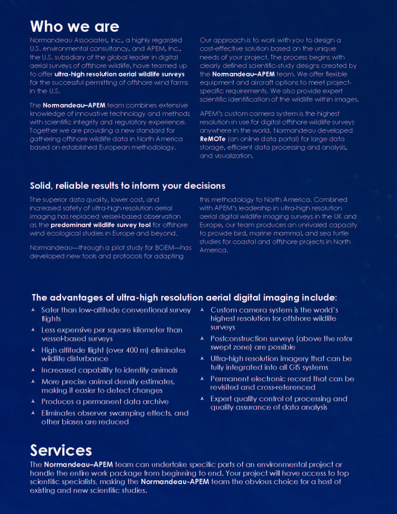
The Normandeau-APEM team is executing the world's largest ever digital offshore wildlife surveys for BOEM and NYSERDA.
Team Projects
●Baseline surveys in the New York State Offshore Planning Area using aerial digital imagery, New York State Energy Research and Development Authority
●Ecological baseline studies of the U.S. Outer Continental Shelf, North Carolina and South Carolina, using aerial digital imagery, U.S. Bureau of Ocean Energy Management
●New York Wind Energy Area monthly aerial surveys, Empire Wind, Equinor
●Aerial survey of seabirds & marine mammals at Ka'ula Island, Hawaii, U.S. Department of Navy
●Everglades mitigation bank monitoring and evaluation of habitats, Florida Power & Light
APEM Ltd.
●Over 1,600 ultra-high resolution digital wildlife surveys completed for major wind farm developers around the world including in the US, UK, Germany and Hawaii
●Strong record of scientific research into the behavior of offshore wildlife at wind farms
●Aerial wildlife surveys of East Anglia One offshore wind farm, the world's first offshore wind farm to be permitted using exclusively digital aerial wildlife surveys; Scottish Power Renewables/Vattenfall
●Aerial wildlife surveys for BARD 1, Germany's most productive offshore wind farm
●Aerial wildlife surveys of London Array offshore wind farm—until recently the largest offshore wind farm in the world; DONG, E.on, Masdar
●Research project employing extremely high quality aerial surveys at a ground-breaking image resolution of 1 cm GSD to successfully survey estuary waterbirds; Natural England
●Surveys of marine megafauna in the Irish Sea; Aberystwyth University and the Countryside Council for Wales
Normandeau Associates, Inc.
●Pilot study of aerial high-definition surveys for seabirds, marine mammals, and sea turtles on the Atlantic Outer Continental Shelf, U.S. Bureau of Ocean Energy Management
●New Jersey offshore wind application for two offshore wind sites and environmental impact analysis of onshore and offshore biological resources, Bluewater Wind
●Environmental assessment for commercial wind leasing and site assessment activities on the Atlantic OCS Offshore Massachusetts (subcontractor to URS), U.S. Bureau of Ocean Energy Management
●Building a database to assess the relative vulnerability of migratory bird species to offshore renewable energy projects on the Atlantic OCS, U.S. Bureau of Ocean Energy Management
●Acoustic monitoring of temporal and spatial abundance of birds near OCS structures, U.S. Bureau of Ocean Energy Management
●Delaware offshore wind environmental services, stakeholder coordination, agency consultation, and application for meteorological tower, Bluewater Wind


.jpg)